- H. H. Lloyd
1871
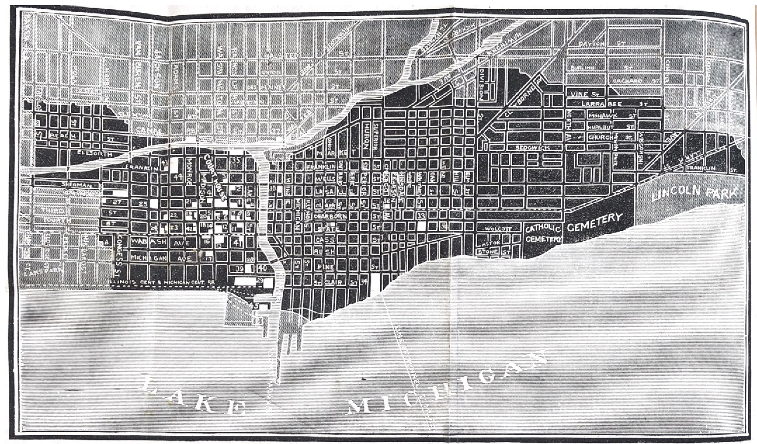
- Burnt District Map
The R. P. Studley Company
St. Louis
This is one of a series of lithographs depicting the fire that were marketed by the Kellogg & Bulkeley Company of Hartford, Connecticut, which was one of many publishers that attempted to capitalize on the fascination with the Great Chicago Fire, which reached across the Atlantic as well as throughout the nation.
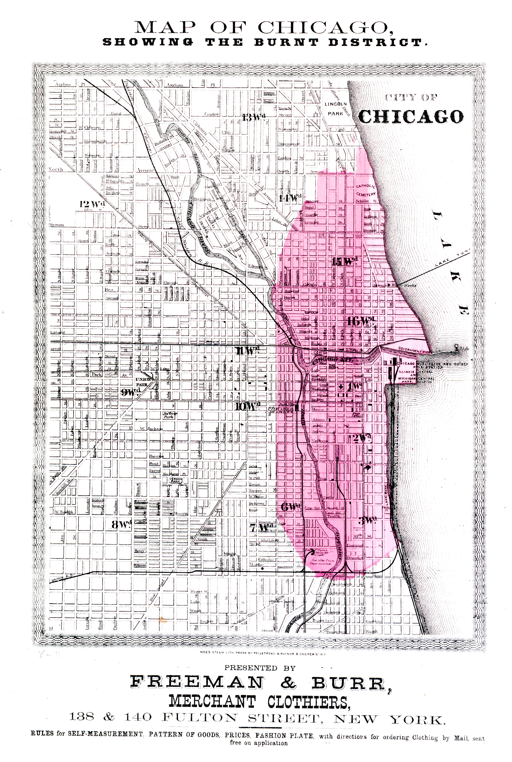
- 1871 Map of the Burnt District produced by New York clothier Freeman & Burr.
Scale: 1:29,300
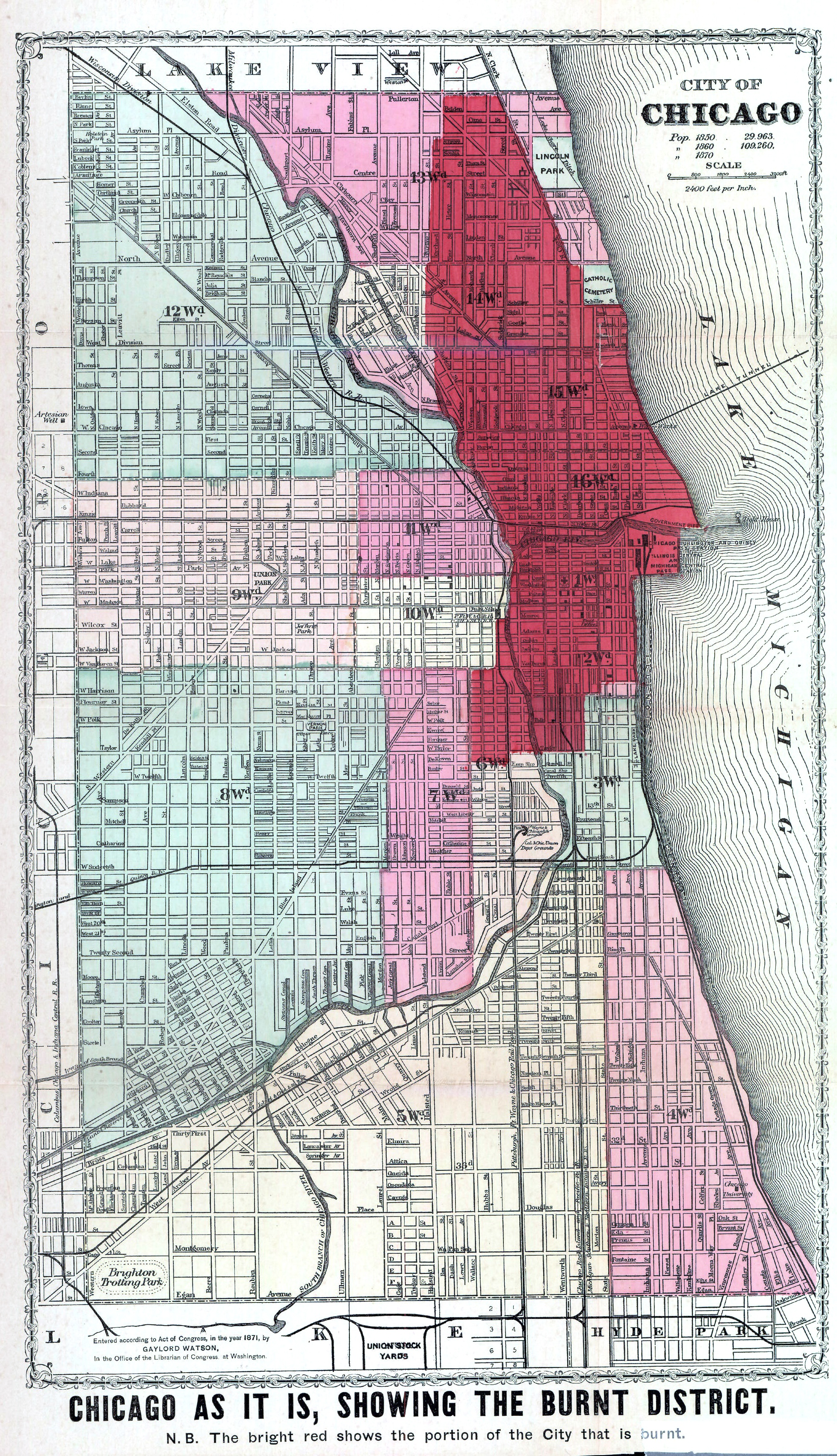
- Chicago As It Is, Showing the Burnt District.
Gaylord Watson, Publisher, 64 Lake street, 1871
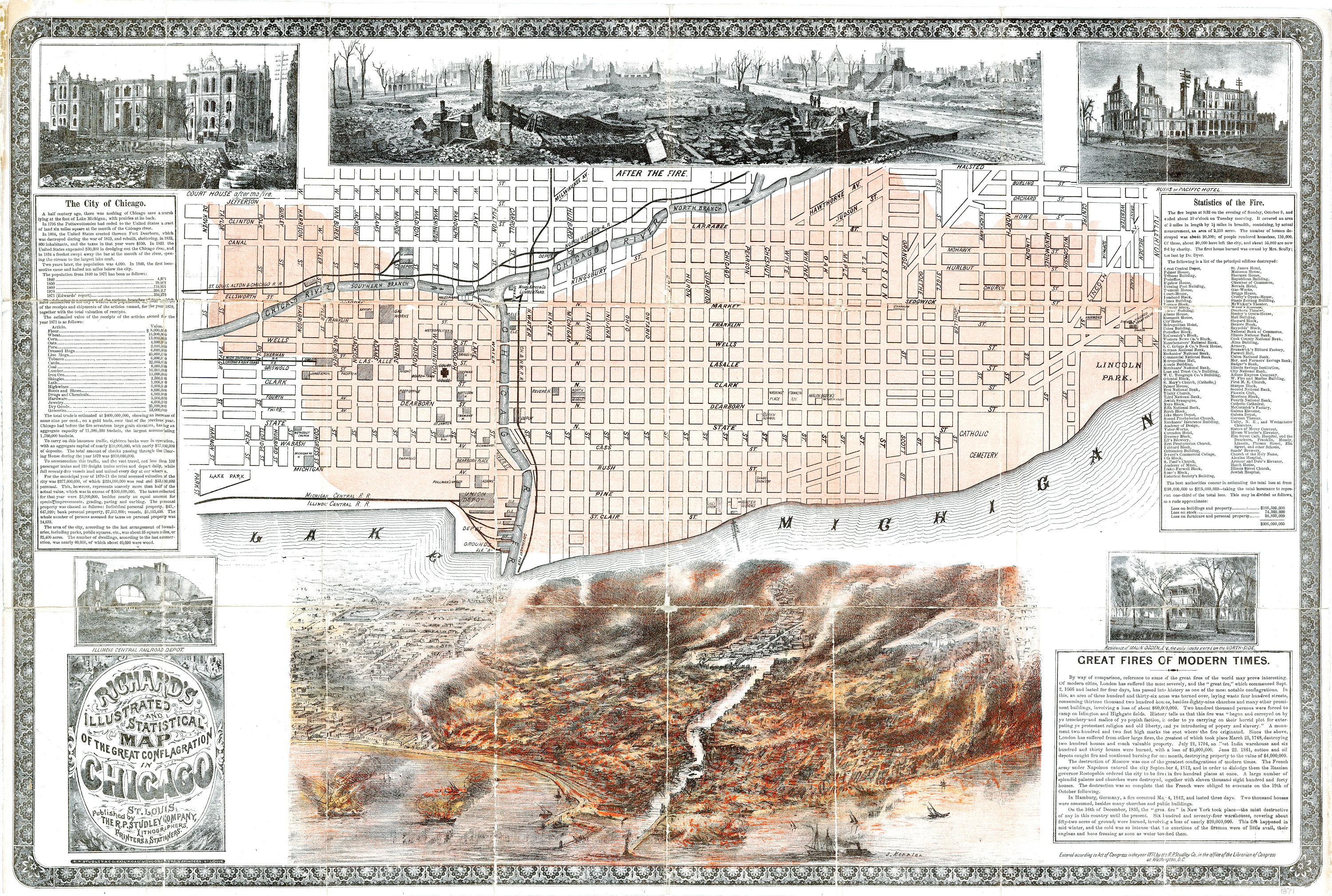
- “The Great Conflagration of Chicago: Its Past, Present and Future” by Associate Editors of the Chicago Tribune, James W. Sheahan and George P. Upton.
Leave a Reply