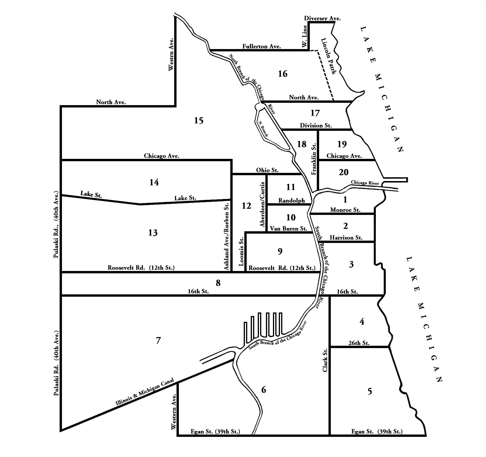
This is how the city’s boundaries were during the Great Fire and when the 1870 Census was taken. Chicago’s population was at 298,977.

Bold indicates city limits. 40th Avenue has been changed in later years to Crawford Avenue and is currently Pulaski Road. Egan Ave (39th St) is now Pershing. Reuben Street is Ashland Avenue today.
Chicago Evening Post, April 9, 1869

- The above cut, which we have caused to be prepared with care, preserving the correct proportions, shows the present shape and boundaries of the city of Chicago, and the boundaries of the wards, which, by recent act of the Legislature, hate been increased from sixteen to twenty in number.
Leave a Reply