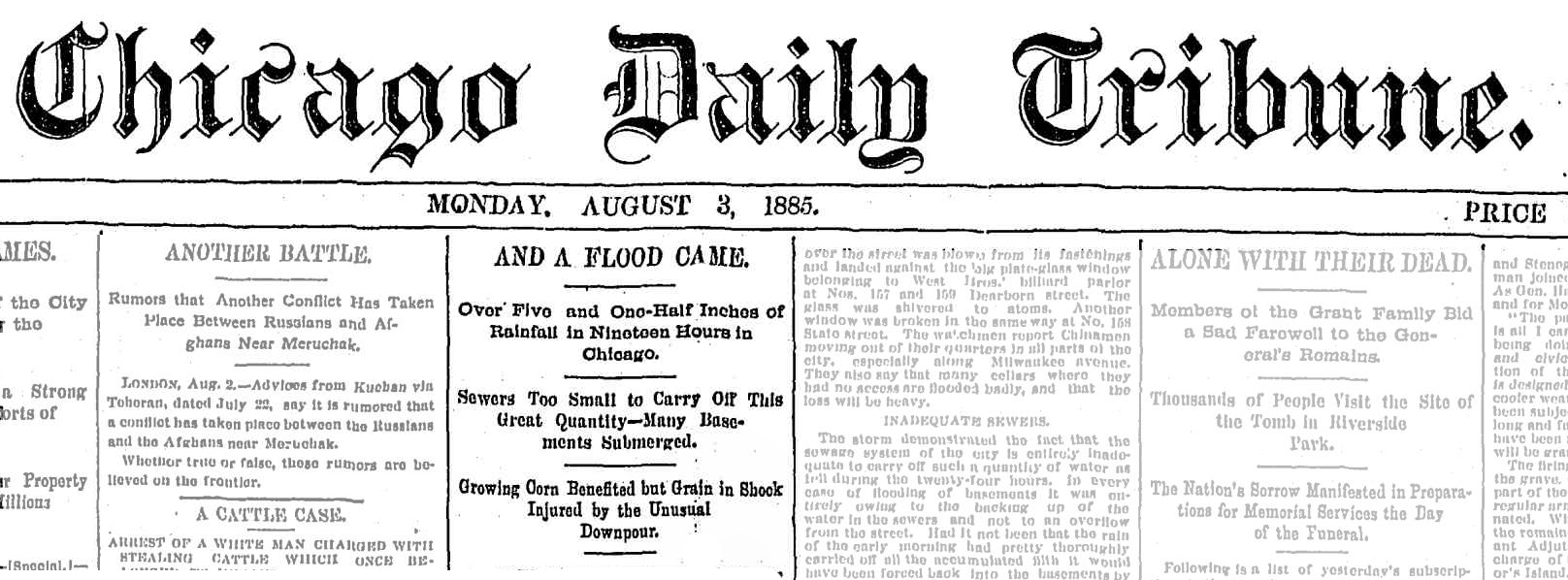
An unprecedented storm dropped 5½ inches of rain on Chicago on Aug. 2, 1885, with all that water finding its way to the river and threatened to enter the city’s intake cribs in the lake which could cause a cholera outbreak that has the potential to kill 90,000 Chicagoans. The only reason for the storm not causing such a catastrophic event was that the weather was cooler than normal.
Chicago Tribune, January 2, 1900
 Chicago is the only great city of the world in which nature has given an unlimited supply of pure water at first hand. That the gift was not appreciated is shown by the way in which the perfect water supply has been polluted, abused, and contaminated for at least two generations by the people for whom it might have been a blessing. But the drainage canal of the Sanitary District of Chicago—one of the greatest engineering works of all time—has been built to bring Chicago into its heritage.
The work of the Drainage board has simply been to restore the ancient relations between Lake Michigan and the Mississippi River, which were interrupted by nature within, what geologists would term recent times. As the waters of the great lakes receded a ridge of limestone rock appeared above the surface from twelve to twenty miles west of Chicago and created the watershed separating the basins of the St. Lawrence and the Mississippi.
It is hard to picture the Chicago River, which has been the sanitary curse of the city for so many years, as having ever been a limpid stream in which fish could be plainly seen playing along its pebbly bottom to a depth of ten feet; but so it was in the early days of the city, and it was not until comparatively recent years that it became a semi-liquid bayou. The water of the stream was used for drinking purposes in the infant days of Chicago, but as the town grew larger wells were sunk, and for twenty years these were depended on for water supply.
The formation underlying Chicago is such that the wells soon became contaminated from the surface and other sources, but through ignorance or carelessness the people continued to use them, although several times the young city was swept and the population decimated by terrible epidemics. For a time these were conveniently ascribed to visitations of divine providence but when science pointed out the true causes the wells were ordered closed and filled up.
ERA OF WATER CARTS.
This brought into existence a new industry—that of water hauling. The water cart consisted of a hogshead mounted on an axle between two wheels and drawn by a horse. The cart was backed into the lake and filled with water by means of a bucket, and the water was peddled through the streets and sold at a shilling a barrel.
The first official action toward giving Chicago a water supply was taken by the Village Council on Nov. 10, 1834, when $95.50 was appropriated for digging a public well at Cass and Michigan streets. In 1840, however, the Chicago Hydraulic company erected a crude water works at the present intersection of Michigan avenue and Lake street, then on the lake front, and ran a pipe 50 feet into the lake. This connected with a tank having a capacity of 500 or 600 barrels, and pressure in the mains was secured by blocking the tank up a few feet from the ground. The works were equipped with a twenty-five horse-power engine, and about two miles of wooden pipe was laid through the city. This primitive system supplied about one-fourth of the population and the remainder relied on the town pump and the water carts for water supply.
It was not until the cholera epidemics of 1849 and 1850 that the growing city awoke to a thorough realization of the necessity of securing a supply of pure water and took steps toward that consummation. The city works were erected at the foot of Chicago avenue and were put in operation in February, 1854, under the control of the Department of Water Commissioners. The water was taken from an intake basin near the lake shore and distributed from three reservoirs located on the North, South, and West Sides, each holding from two or three days’ supply. These reservoirs were in use until the completion of the West Side tunnel in 1874.
But the water was still taken from the inlet near the shore, and after storms it was muddy, and the number of small fish supplied with the water became a serious nuisance. The question of running a tunnel far into the lake began to be agitated in the early ’60’s, and, after much opposition had been overcome, the contract was let and ground was broken for the tunnel on March 17, 1864. It was to be two miles in length, starting from the foot of Chicago avenue, and it was completed on Dec. 6, 1866. The system water pipe tunnels under the river was not put in operation until 1869. The second lake tunnel was completed in 1874 and the four-mile tunnel in 1892.
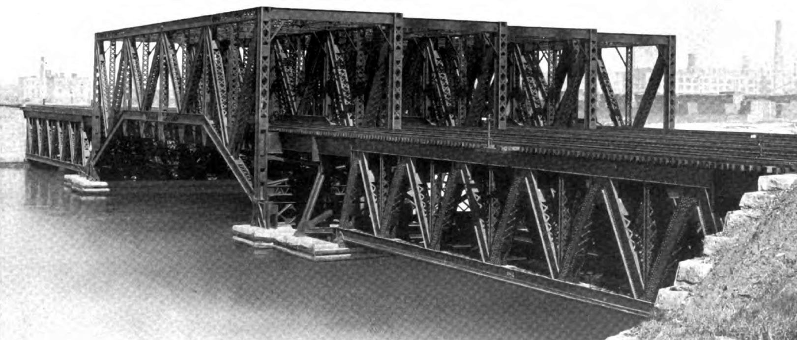
- Western Avenue Bridge (Eight Track Bridge)
Across the Main Drainage and Ship Canal
1901
FIRST SEWERAGE SYSTEM.
The problems of the disposal of sewage and of pure a pure water supply are closely related, but it was not until 1855 that a sewage system was given any though or attention in Chicago. Wooden boxes were submerged in a few of the principal streets which these were used solely for surface drainage, and in wet seasons they were inadequate to carry away even the surface water.
The awakening did not come until the city had been scourged by epidemics for six consecutive years. The cholera killed 5½ percent of the population in a single yearand the average annual death rate for six years was 48.02 in a thousand.
In 1855, a Board of Sewerage Commissioners was created. E. B. Chesborough of Boston was appointed chief engineer and the work of constructing sewers was begun in the spring of 1856. Some of these early sewers were partially above ground and others entirely so. In the general arrangement the mains were placed in the alternate streets running to the river. The work progressed with tedious slowness and only a small territory in the heart of the city was equipped with sewers in two years.
Many schemes were suggested for flushing the river and its branches and keeping the waters fresh, and finally Mr. Chesborough was sent to Europe to inspect the methods used in the principal cities abroad.
In the report submitted after his return he suggested practically the scheme which has since been carried into effect by the trustees of the Drainage board. “The through out,” he wrote, “for a steamboat canal to the Illinois River, which the demands of commerce are calling more and more loudly for, if ever constructed, would give as perfect relief to Chicago as is proposed for London by the latest intercepting scheme.”
But the city’s sewerage system was construed as originally planned with the addition of several large trunk sewers in the North and West Divisions. The system, though primitive, showed an immediate result in the decrease of the death rate. In 1854 the rate was 53.9 in the thousand. This declined steadily until 1860, when it was 18.8, which it has remained about the average rate.
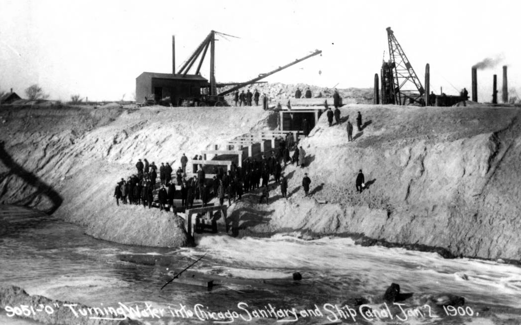
- Sanitary and Ship Canal
Turning water into canal
January 2, 1900
RIVER STILL A MENACE
As the city increased in population the problem of cleansing the Chicago River became more urgent of solution, and the Sewerage commissioners in 1860 again drew attention in the necessity of establishing communication between the waters of Lake Michigan and the Illinois River. Nothing was done, but the hope was constantly held out that someday the Illinois and Michigan Canal would be cut down at its summit level so as to create a flow from Lake Michigan. As a makeshift an appeal was made to the Canal board of the Illinois and Michigan Canal to keep the pumps at Bridgeport in operation as much of the time as might be necessary to maintain a “good” condition of the Chicago River.
In 1862 City Engineer Chesborough again reported on the drainage of the city sewerage into the Illinois River, the diversion of the Desplaines River into the South Branch, and various other expedients, but his suggestions were balked by the question of expense.
The matter was agitated for a long time, and all interests united in the belief that the only solution of the problems of securing pure water and disposing of sewage lay through an outlet to the Illinois valley. There was no suggestion at that time of an independent channel, but hope pf relief was directed toward the Illinois and Michigan Canal. Finally the plan was adopted of deepening the canal, and money was raised for that purpose. The work was finished in 1871, at a cost of $3,300,000 and the result was eminently satisfactory for a time. But the relief was only temporary.
JOLIET’S CANAL PLAN.
Many Chicagoans have claimed the distinction of first suggesting the restoration of a waterway between the great lakes and the Mississippi, but history gives precedence for the suggestion to Père Joliet. In August, 1674, he wrote:
- We can easily go to Florida in boats and by a good navigation. There would be but one canal to make, by cutting only one-half a league of prairie, to pass from the Lake of the Illinois into St. Louis River.
And by this he meant the identical cut that has been made by the trustees of the Sanitary District of Chicago. The same suggestion has been made by scores of men since the time of Joliet, but it is only fair to give him the credit of having breached the subject.
Throughout the early days of the century the idea of a waterway between the lakes and the Mississippi was constantly brought forward. At that time the object aimed at was purely a commercial one. In 1818 William Darby wrote:
- No doubt now remains but that the Chicago and Illinois Rivers afford far the most natural connection between the southern and northern waters of the United States. If the people of the United States ought ever to unite in opening any channel of communication, it is that by the Illinois River and Lake Michigan. If the various points from St. Louis to Buffalo were united by commercial facility, a numerous population would be the immediate consequence.
The feeling in favor of such a canal as is now an accomplished fact cropped out at intervals in the most unexpected places. C. F. Hoffman, a New York editor, visited this part of the West in 1833, and writing from Chicago to the Knickerbocker Magazine said:
- There is one improvement to be made, however, in this section of the country, which will greatly influence the permanent value of property in Chicago. I allude to a canal from the head of Lake Michigan to the head of steam navigation on the Illinois, the route of which has been long since surveyed.
TREATY WITH THE INDIANS.
The first step looking towards the construction of a canal was taken away back in 1816, when a treaty was negotiated with the Indians whereby the latter ceded to the government a strip of land about twenty miles wide extending through the Desplaines and Illinois Valleys from Chicago to Ottawa. This grant, containing 9,911,411 acres, was ceded for a trifle, on the understanding with the aborigines that a canal should be built, and that it should redound greatly to their benefit, but a few of them lived to see even the old Illinois and Michigan Canal.
In 1825 the Legislature incorporated the Illinois and Michigan Canal association, and granted it extraordinary privileges. When the construction of the canal was finally assured, Western immigration received a great impetus, and the population of Illinois was nearly doubled in five years. But the actual construction of the canal was delayed many years, and no less than forty acts were passed by the Legislature relating to the subject. The formal opening of the Illinois and Michigan Canal took place on April 23, 1848, and was celebrated with much rejoicing. Its total cost was $6,537,254.
For years Congress was urged to build a practical ship canal between Lake Michigan and the Mississippi, and the matter was agitated in almost every State in the union, but all to no effect. The Representatives from Ohio and Indiana were the dogs in the manger, they taking the stand that the project was for the benefit of a single State. The scheme received a little impetus during the civil war,and one bill presented authorized the construction of a ship canal for the passage of armed and naval vessels from the Mississippi River to Lake Michigan “and for other purposes,” but nothing came of it.
CANAL CONVENTION IN 1863.
Within a month after the defeat of the ship canal bill in Congress in 1863 a call, signed by most of the prominent members of Congress, was issued for a canal convention to meet in this city in June of that year. The convention met in a tent on the lake front and delegates were present from many business associations throughout the North, but there was no practical result.
General J. H. Wilson made an examination of the Illinois River on behalf of the government in 1867 with a view to connecting it with Lake Michigan. this was followed by a survey later in the year to determine the costs of the improvement. Other surveys followed and Engineers Wilson and Gooding had estimated the cost of a water route from the lake to the Mississippi River at $18,217,242. There the matter rested until 1882 when the government ordered a survey of the Illinois and Michigan Canal with a view to enlarging that ditch to the size of the Hennepin Canal.
In 1885 Congress appropriated $200,000 for the improvement of the Illinois River and ordered still another survey for a serviceable waterway between Chicago and the Mississippi. Several routes were suggested, and the government experts indulged in a great deal of speculation and correspondence.
During all these years of scheming, delays, and hopes deferred, sanitary conditions in Chicago were growing rapidly worse, and the problem of securing an effective sewerage system was one demanding swift solution. Hundreds of remedial measures were suggested and some adopted, but all these were in the nature of makeshifts. The true solution was recognized by every one conversant with the conditions, but the question of cost seemed an insurmountable obstacle.
The scheme frequently urged was the boring of artesian wells in the hope of securing sufficient water to flush the river, but investigation showed that it would require not less than 500 wells to accomplish this purpose, and the scheme was finally condemned as impractical. The Fullerton avenue conduit was constructed, and had some beneficial effect, but it was only a small item in the general scheme of purifying the river and its branches.
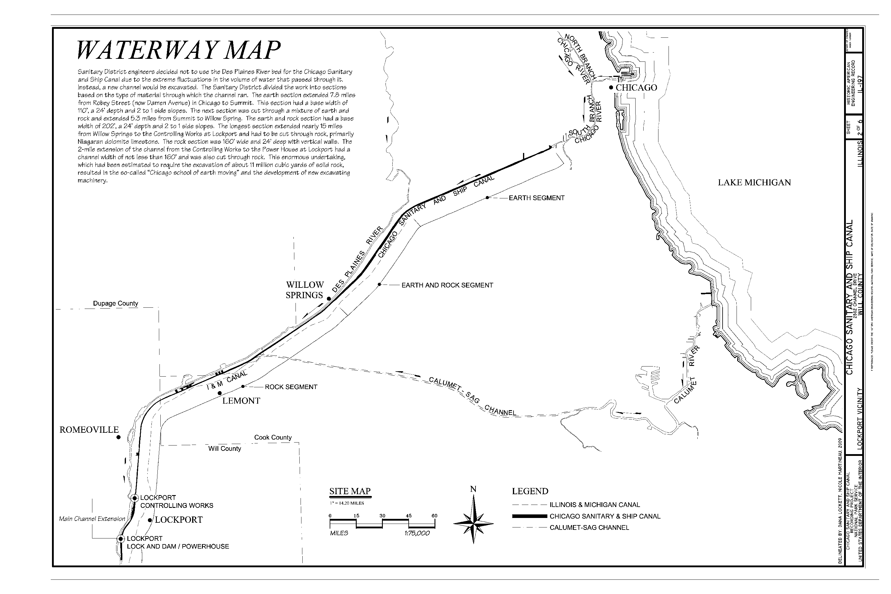
- Waterway Map
Chicago Sanitary and Ship Canal
Extends 33.9 miles from Chicago to Lockport
CITIZENS’ ASSOCIATION.
The Citizens’ association of Chicago did much between 1880 and 1889 in inciting the public sentiment to a demand for better drainage. Experts were employed and committees of citizens worked with them. Canal schemes and intercepting sewers were discussed and out aside, and finally sentiment crystallized on the drainage canal proposition as the only possible one for the definite solution of the problem.
Following the recommendations of the Chicago Citizens’ association, the City Council authorized the creation of a drainage and water supply commission in January, 1886, and Mayor Harrison appointed Rudolph Hering as chief of the commission and Benezette Williams and Samuel G. Artingstall as assistants. This commission made elaborate investigations and reports and the logical outcome of it all was the creation of the Chicago Sanitary District.
The first official step taken in that direction was the passage of joint resolution by the Legislature providing for the appointment of a committee of five, consisting of the Mayor of Chicago, ex-officio, two members of the House, and two members of the Senate, to examine and report on the subject of the drainage of Chicago and its suburbs. The committee was composed of Senators Bernard . Ecjhart and A. J. Bell, Representatives T. C. MacMillan and T. H. Riley, and Mayor John A. Roche.
The committee held many public meetings and had many conferences with the people of the Desplaines and Illinois River valleys during the following two years, and as a result of its work and recommendations the act creating the Chicago Sanitary District was passed and went into force on July 1, 1889.
VOTE IS 70,958 TO 242.
The district was defined and organized the same summer and on Oct. 4 Judge Prendergast issued an order requiring that the question of the establishment of the district be submitted to the people at the election to be held on Nov. 5, 1889, as provided by law. The vote was 70,958 for and 242 against.
The Sanitary District of Chicago is eight miles long, from north to south, and about nine and one-half miles wide on a line passing through the Courthouse in Chicago. Its extreme width from east to west is about fifteen miles, and the district has an area of 185 square miles.
On Dec. 12, 1880, following the general election at which the Snitary District was established a special election was held for the election of trustees. The successful candidates were: John J. Altpeter, Arnold P. Gilmore, Christoph Hotz, John A. King, Murry Nelson, Richard Prendergast, W. H. Russell, Frank Wenter, and H. J. Willing. The board met on Jan. 18, 1890, and at the third meeting, held on Feb. 1, Mr. Nelson was elected president, Austin J. Doyle, clerk; Byron L. Smith, Treasurer; L. E. Cooley, Chief Engineer; S. S. Gregory, attorney; and Charles Bary, Secretary. The salary of the President was fixed at $4,000 a year and that of the other trustees at $3,000 each. Friendly suits were brought against the board at an early stage to test the validity of the law, and it was sustained.
EARLY DISSENSIONS.
Then followed the dark days in the history of the great enterprise. Dissensions in the board cropped out early in its existence, and in two years not one step of progress was taken, and more than a half a million dollars was expended without securing tangible result. Although a straight path had been cut out for the board, a majority of the members refused to follow it, and some of the trustees even attempted to tamper with the law. Chief Engineer Cooley was instructed to make surveys and examinations that would enable the trustees to select one of not less than four routes for a channel of the size required by law.
After Mr. Cooley had started his work some of the trustees protested against the expense in it and President Nelson suggested that the work be stopped. Mr. Cooley replied to the protest that his instructions gave him no alternative but to go ahead, and elaborate investigations were continued. But the board became impatient and ordered the Chief Engineer to file a report within thirty days to which Mr. Cooley replied that it would be impossible to comply with the order. The board insisted on an off-hand report, and on Dec. 10 Mr. Cooley sent in his resignation.
On the same date General John Newton was elected consulting engineer, and a week later William E. Worthen was chosen to succeed Mr. Cooley as Chief Engineer.
Early in 1891 the trustees came to the conclusion that it would cost more money than could be raised for the purpose to carry out the work as contemplated by the law, and a statement was made to the citizens of the sanitary district urging an ammendment of the law by which the cost of the smallest channel permitted by law at $26,800,000, and the trustees declared that there was no provision under the law for raising such a sum.
The attempt to amend the law did not meet with oublic approval, and the Legislature declined to take action. Time went on and nothing was done, and the trustees were severely scored for the delay. Trustees Nelson and King resigned on Auf. 26, 1891, and Trustee Willing sent in his resignation on Sept. 23. At the following election these vacancies were filled by the election of Bernard A. Eckhart, who had worked hard and efficiently for the creation of the Sanitary District as State Senator; Lyman E. Cooley, formerly Chief Engineer; and William Boldenweck.
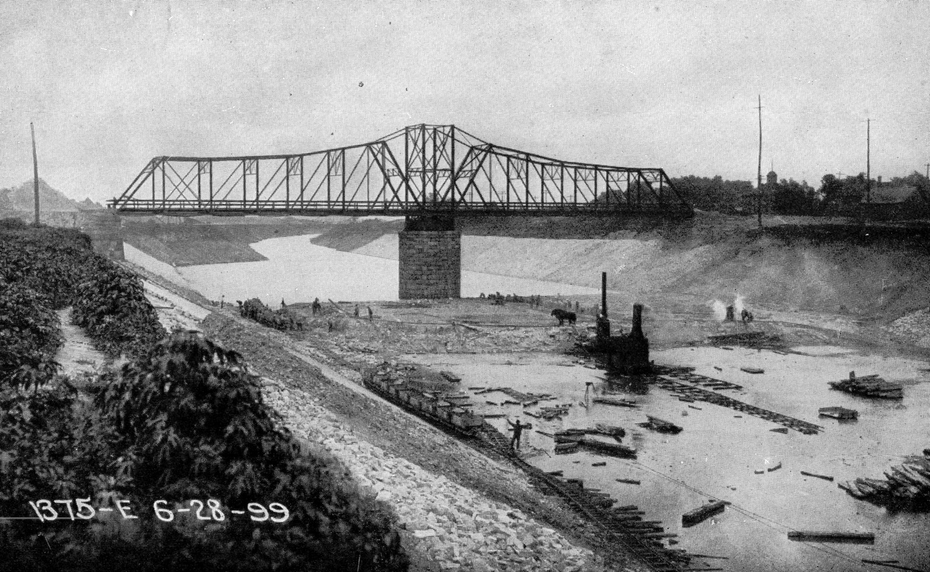
- Building the Chicago Sanitary and Ship Canal
June 28, 1899
BEGIN TO PUSH THE WORK.
With these accessions to the ranks of the progressive trustees, efforts were made at once to go ahead with the work. Then Trustee Hotz handed in his resignation on Jan. 16, 1892. This vacancy was not filed until the following election, when Thomas Kelly was chosen by the voters.
The engineers continued to submit new plans and propositions, and the board passed many resolutions without regard to engineering possibilities. Engineers Worthen and Newton resigned, and Samuel G. Artingstall suggested several routes, and the one between Summit and Lockport was finally adopted.
Toward the close of 1891 the trustees borrowed $100,000 from the city banks to meet current expenses. The total expenditures of the district to Nov, 28, 1891, amounted to $660,330, and nothing had been accomplished.
Progress dates from the organization of the board on Dec. 8, 1891, when Trustees Eckhart, Boldenweck, and Cooley took their seats, and Trustee Wenter was elected President. In the latter’s address he declared that the dimensions and the scope of the channel prescribed by law could not be safely diminished, and he was supported by a majority of the board. He chose as his lieutenants the following chairmen of committees: Finance, Trustee Eckhart; Engineering, Tristee Cooley; Judiciary, Trustee Boldenweck; Federal Relations, Trustee Gilmore.
The Engineering committee, after an investigation, recommended several changes in the route and in details. Chief Engineer Artingstall resigned, and Benezette Williams was elected to succeed him. He recommended further changes in the route, and the oresent one was finally adopted. Bids for construction work and excavation were invited in April, 1892, and opened in June and contracts were awarded in July.
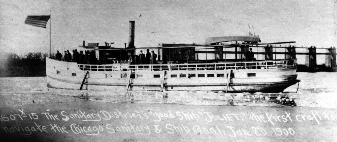
- “Juliet”
First Vessel to Navigate Canal
January 20, 1900
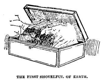
“SHOVEL DAY” CELEBRATED.
Work on the main drainage channel was inaugurated on Sept. 3, 1892, with impressive ceremonies and before an immense crowd of people and distinguished guests. This was known as “shovel day,” and ground was broken at a point two miles west of Lemont on the boundary line between Cook and Will counties. At the conclusion of President Wenter’s address he raised a shovelful of earth from its native bed and deposited it in a tin box held by Trustee Boldenweck, and this box is preserved in the offices of the Drainage board as a memento of the inauguration of one of the greatest engineering works of history.
The last act of the ceremonies was performed by Trustee Cooley; when he touched an electric button that fired the first blasts of rock in the bed of the channel. Addresses were made by President Francis Wenter, Trustees Eckhart and Cooley, Corporation Counsel Miller, Dr. Frank W. Reilly, Carter H. Harrison, ex-Senator Macmillan, Mayor Haley, and Fernando Jones.
The original contracts of the work on the canal thus started over seven years ago called for its completion on April 3, 1896, and on that date eleven sections of about one mile each were practically done. But the appearance of unexpected obstacles delayed the completion of the whole over three years from the date originally set.
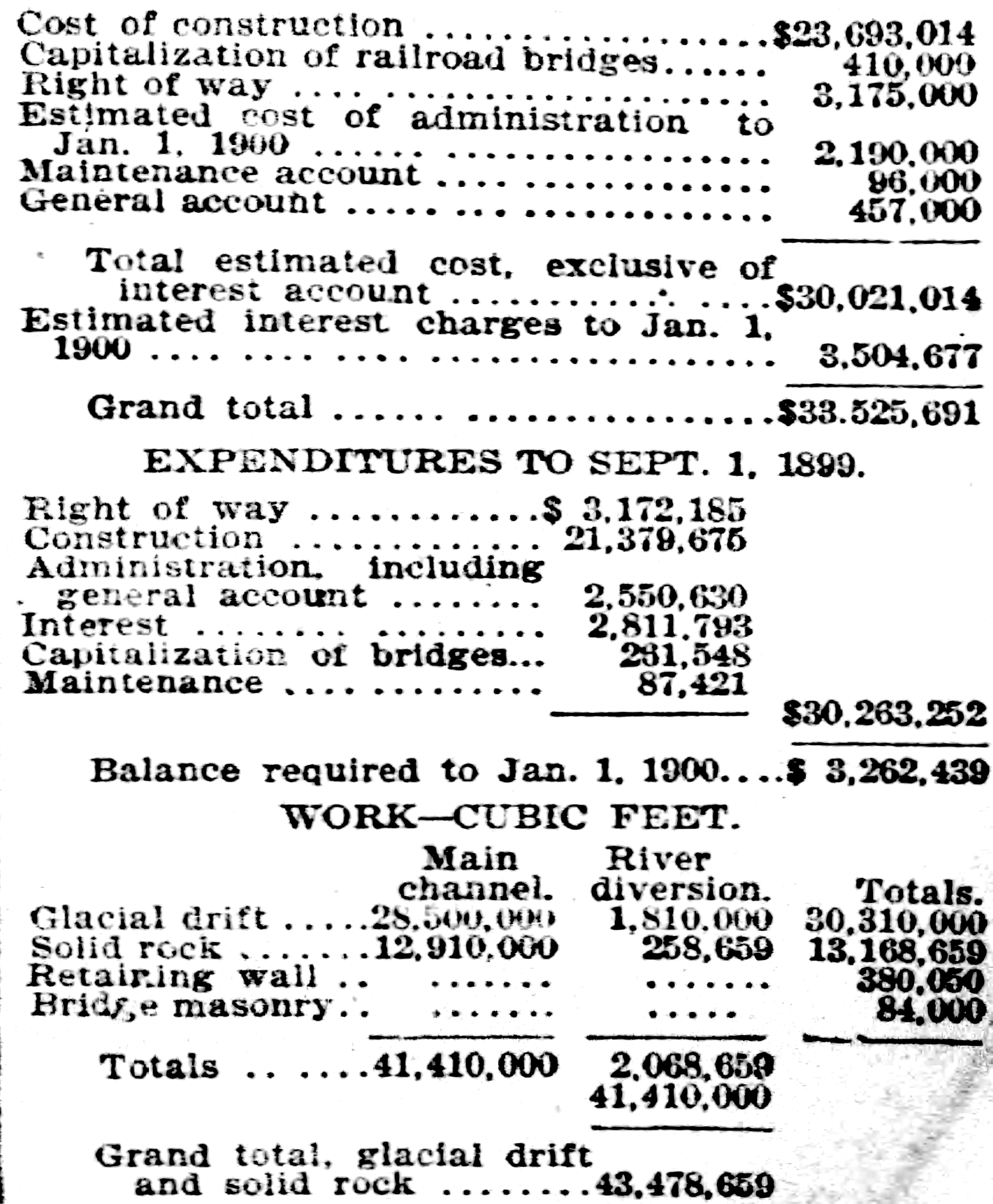
WORK TOLD IN FIGURES.
The figures involved in this stupendous undertaking are interesting. The excavation of the main channel called for the removal of 28,500,000 cubic yards of glacial drift and 12,910,000 cubic yards of solid rock, or an aggregate of 41,410,000 cubic yards, to which must be added the material excavated for the river diversion, of 43,478,659 cubic yards. The retaining walls contain 380,050 cubic yards of stone. Rock when broken up expands about 80 per cent, and consequently the volume of the rock piles along the banks of the canal is about 22,078,000 cubic yards. If the entire volume of the excavated material was deposited in Lake Michigan in a depth of forty feet of water, it would make an island one mile square, with its surface twelve feet above the water line.
The largest amount of material excavated in any one month since the work began was in August, 1894, when 1,201688 cubic yards of glacial drift and 418,164 cubic yards of solid rock were taken out; but the largest estimate returned was for the month of June, 1895, amounting to $742,365, representing the excavation of 959,074 cubic yards of glacial drift and 565,500 cubic yards of solid rock and the laying of 13,7799 cubic yards of masonry in cement. During the month of July, 1894, 74,800 cubic yards of solid rock were remove from section 3 alone, and this made a record for a single contract which had never been equalled in all the ages since man first began to quarry stone. It was eclipsed by the contractors of section No. 14, howver, in April, 1895, when they excavated 86,400 cubic yards of solid rock.
COST OF THE ENTERPRISE.
The cost of the construction of the main channel and auxiliary work paid and estimated to Jan. 1, 1900 is as follows:
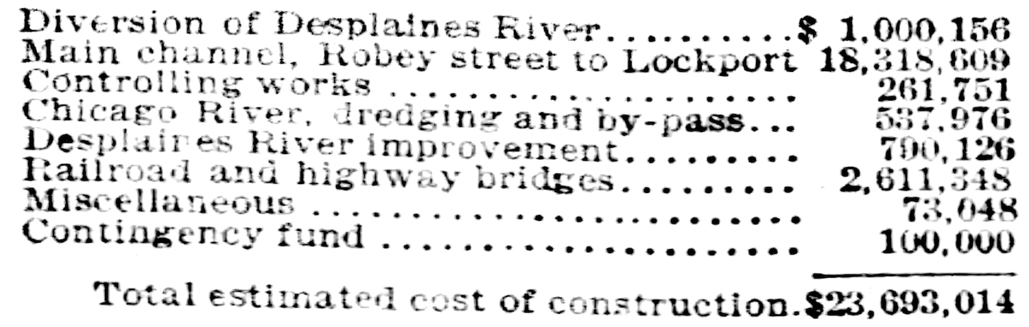
The figures of cost and excavation, as recently submitted to the Board of Trustees by Chief Engineer Randolph, including that of the construction—$23,693,014—are as follows:
OTHER CITIES COMPARED.
Trustee Eckhart has compiled some statistics in regard to similar works undertaken by the great cities of the world, and from them makes some interesting comparisons. London, founded 400 years ago, has a population of about 4,000,000. Chicago, founded about sixty years ago, has over 1,500,000. The Metropolitan Board of London was established in 1855 for the purpose of constructing a new sewerage system. It got to work in 1856 had expended $35,000,000 in main sewers alone.
In London water service has been for many years in the hands of private companies. The service is regarded as deficient and an attempt was made by the municipal government not long ago to buy out the private plants, with the intention of replacing them with an improved system. The private companies finally agreed to sell, but demanded the sum of $177,000,000. On the advice of eminent engineers, the city declined to make the purchase, and arranged for the outlay of $68,000,000 in securing a supply of drinking water from the chalk stra(?) to the amount of four gallons a day for each inhabitant and an unlimited amount of river water for general use. But even under this arrangement London is badly off, as the drinking water supply is wholly inadequate and the drainage is radically imperfect.
PARIS’ GREAT PROJECT.
The City of Paris, with its many canals, aqueducts, reservoirs, filtrations, and other improvements, on which over $40,000,000 has been expended since 1856, would seem to be well off for a city of 2,500,000 people. But even with this outlay, and an even greater one for sewerage, the needs of the inhabitants are not met. Engineers recently were asked to prepare plans and estimates for cutting a canal from Paris to the sea, a distance of 111 miles. The cost of such a scheme will be enormous, but it is necessary and it is not doubted that the Parisians will pay it cheerfully.
In Manchester, England, there are only 379,800 people, but they have under discussion a project for bringing a limited supply of water form Thirimere Lake, a distance of over 100 miles, at a cost of $18,000,000.
Liverpool gets a daily supply of 13,000,000 gallons for 613,463 people at an original cost of $10,000,000. The water is conveyed a distance of sixty-eight miles by aqueducts and steel tubes, which pierce several ridges, cross a number of small streams and canals and run under the Rivers Weaver and Mersey, and the Manchester chip canal. And even sfter this great trouble and outlay the supply is scanty.
The people of Vienna have expended $10,000,000 in getting water from the mountains, fifty-eight miles away, and their only regret is that they didn’t pay more money when they were doing the work and get a larger supply.
The people of Glasgow got a supply of water from Lake Katrine, about thirty-five miles away, at an original cost of $9,000,000.
NEW YORK’S PROBLEM.
New York was compelled to go into the country forty miles and collect the waters of small streams into artificial lakes for its water supply. These are more or less contaminated and constant efforts are required to check the pollution. Dams, aqueducts, and tunnels have cost the city nearly $30,000,000, and still the system must be extended as the city grows. Plans have been adopted recently for the construction of a new dam which will collect the waters of region 376 square miles in extent. This and its auxiliaries will cost $5,000,000.
Boston goes to Lake Cochituate for its water supply, a distance of twenty miles, and has paid more than $10,000,000 for storage reservoirs and a brick conduit.
Philadelphia is supplied mainly from the Schuylkill River, whose waters are deleteriously affected by the sewage of towns and the waste of factories. Three plans for an improved supply are now under consideration, any one of which will cost not less than $20,000,000.
Versailles spent large sums of money and sacrificed many lives in an unsuccessful attempt to bring water from the river Eure, and the famous aqueduct bridge of Maintenon is the most significant structure of the kind in the world. Finally, the waters of the plateau between Versailles and Rambouillet were collected and led, by channels ninety-eight miles in length, to and through the city.
Constantinople brings its water through valleys and by aqueduct from the Valley of Beigrade, a distance of fifteen miles.
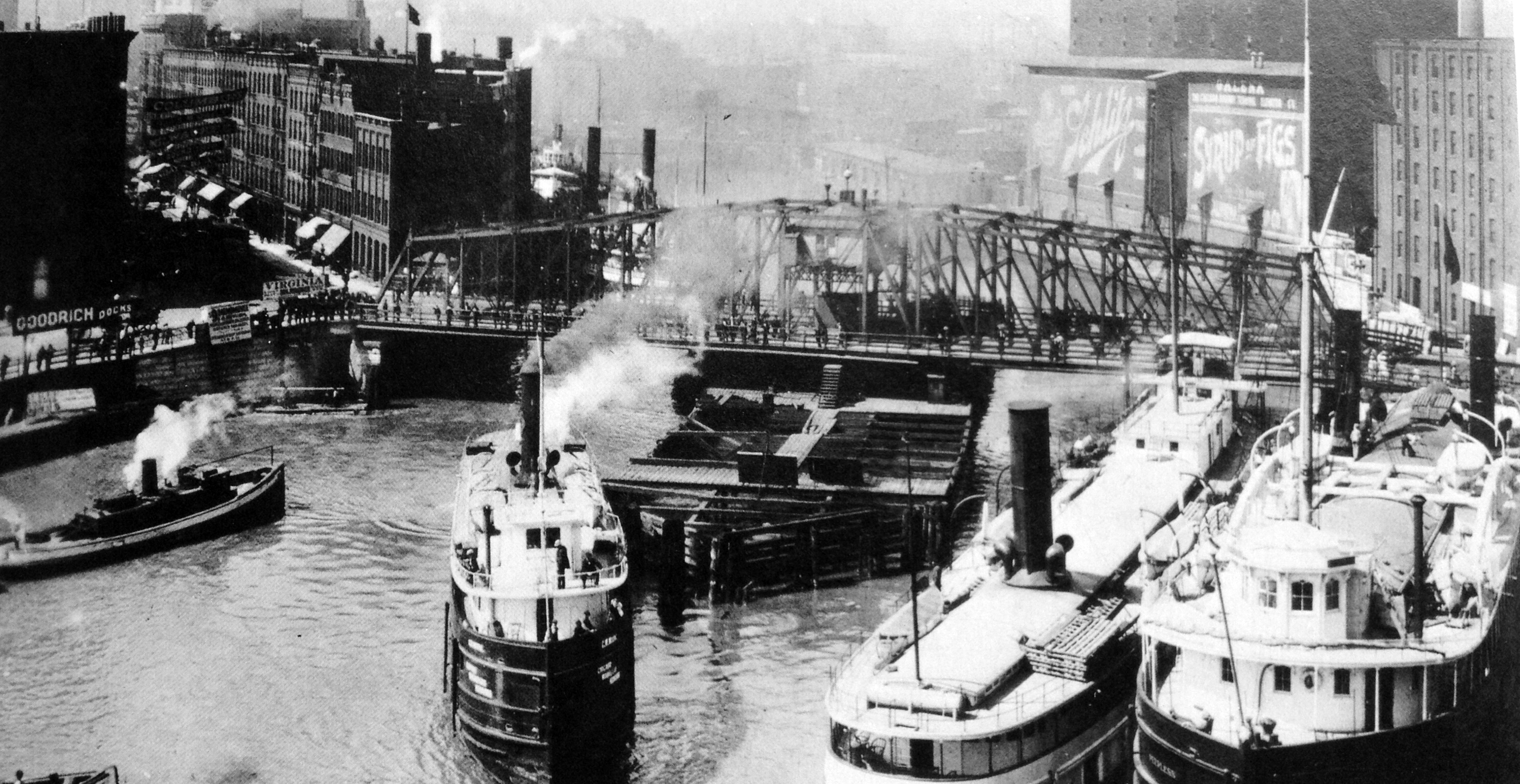
- Chicago River with Rush Street Bridge
Circa 1900
CHICAGO STATISTICS.
Chief Engineer Randolph recently compiled some statistics in regard to Chicago that are striking. In its incorporated area of 187 square miles is a population of 1,616,000 souls by the last census, 2,570 miles of streets, 1,183 miles of which are paved and improved; a water system comprising in its source of supply a range of ten miles of lake frontage, and with a daily capacity of 484,000,000 gallons, and six main pumping stations, whose daily output is given as 357,500,000 gallons; 1,682 miles of water mains veining its streets, all built at a cost of $25,369,215. The city has 1,366 miles of sewers, built at a cost of $17,661,000. The Chicago River has a dock frontage of forty-one miles. The business of this port, by a recent report, amounted to 6,428,000 tons of clearance, carried in 8,552 vessels, or a total of nearly 13,000,000 tons carried in 16,000 vessels—4,820 more arrivals than are registered from the port of New York, and only 820 less than all the arrivals from Boston, Philadelphia, Baltimore, New Orleans, and San Francisco for the same period.
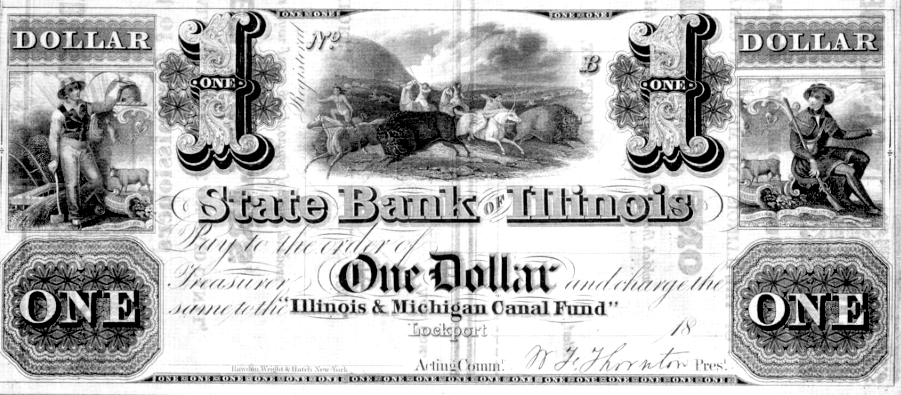
- Illinois & Michigan Canal Scrip
EPILOG
|
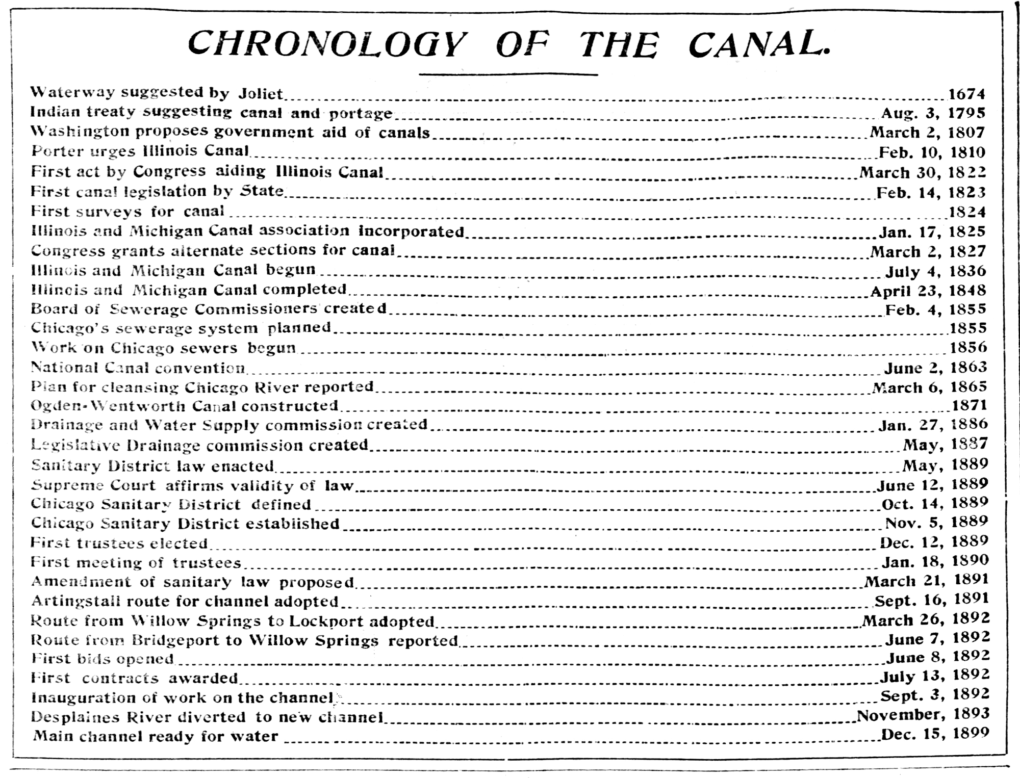
CHRONOLOGY OF THE CANAL
|
|
| The northernmost section of the I&M Canal between Chicago and Lockport is permanently closed to traffic. |
1910
|
| Construction begins on the 16-mile long Calumet-Saganashkee (Cal-Sag) Canal |
1911
|
| I&M Canal experiences a brief resurgence during World War I |
1914-1918
|
| The Illinois General Assembly transfers control of the I&M Canal to the Illinois Department of Public Works and Buildings. |
1917
|
| Cal-Sag Channel opens, reversing the flow of the Calumet River and connecting the Calumet River to the Chicago Samitary and Ship Canal |
1922
|
| The Illinois General Assembly transfers control of the I&M Canal to the Illinois Department of Purchases and Construction. |
1925
|
| The Ilinois Waterway, a series of locks and dams that regulate the Illinois River at a depth of 9 feet opens, and the LaSalle-Joliet section of the I&M Canal officially closes. |
1933
|
| The Civilian Conservation Corps (CCC) establishes five camps along the I&M Canal from Willow Springs to LaSalle to amke repairs to the canal |
1933
|
| The CCC develops bridle paths, foot trails, trailside shelters, comfort facilities, and shrubbery and constructs picnicking accommodations |
1933-1938
|
| Designation of Illinois and Michigan Canal State Parkway from Joliet to LaSalle, built by the CCC to connect the recreational areas along the canal. The canal begins to be used solely for recreational purposes. |
1935
|
| Charles M. Gates writes a Historical Report on the Illinois & Michigan Canal at the request of the director of the National Park Service. |
1936
|
| The United States government relinquishes the title to the Illinois and Michigan land and cedes it to the State of Illinois. |
July 1, 1947
|
| The I&M Canal and adjacent areas become a state park. |
1955
|
| The I&M Canal is designated a National Historical Landmark |
1964
|
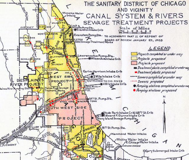
- The Chicago Sanitation District
1925
Leave a Reply