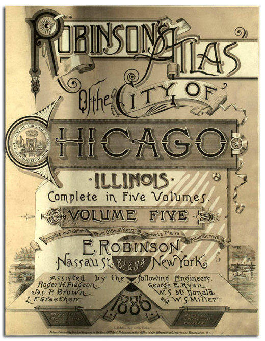
The Robinson’s Atlas of the City of Chicago was one of several surveys performed after the Great Fire of 1871. The purpose of these books was to provide outlines of all buildings as well as a color coded system to identify the building’s building materials in case of fire for insurance purposes. This brilliantly designed illustration is from the Title Page of Volume Five. The books were published in 1886.
Terry Gregory
Chicagologist
This is great info to know.
Where can these books be found and viewed?
The easiest place to see the maps is through the Encyclopedia of Chicago website:
http://www.encyclopedia.chicagohistory.org/pages/11479.html
Later Sanborn’s fire insurance maps can be accessed online at any Chicago Public Library. If you have a CPL library card, you can log in from home.
Sanborn maps can be ordered through Library of Congress on-line
Volumes 1 through 4 of the 1884 Robinson Fire Maps can be downloaded for free at http://www.uic.edu/depts/hist/hull-maxwell/maxwell/chapters/russheb/section8/Robinson-CHICAGO/HTML/V1/V1IndexImageMap.htm